|
Once more the unusual dry and hot conditions
in Central America and Mexico have resulted in many fires
throughout the region during the 2005 dry season. Virtually
all of these fires are set by farmers preparing their fields.
Under the current dry conditions, these fires escape into
the surrounding forest with devastating results. Normally
the fire situation gets serious around May, but this year
the most heavy burning took place in April. The dry season
ended late May.
The maps below have been generated using MODIS
active fire data. Click the images for a larger file
(gif). Green lines represent protected areas boundaries.
The MODIS
active fire data are produced by the MODIS Rapid Response
System, a collaboration between the NASA Goddard Space Flight
Centre (GSFC) and the University of Maryland (UMD).
 |
Accumulated
fires for May 2005, Notice:
-
Decrease of fires in neighboring
Peten (Guatemala), Decrease possibly a result
of the 2004 experience. In that year the rains
came early and this year farmers probably decided
to be on the safe side and did most of their burning
in April
-
continued
burning of cleared vegetation in the Chalillo
dam area. Fires escaping into the Mountain
Pine Ridge Forest Reserve?
-
Savanna fires in the coastal plains.
-
Agricultural fires in the south
of the Columbia River Forest Reserve.
|
| 
|
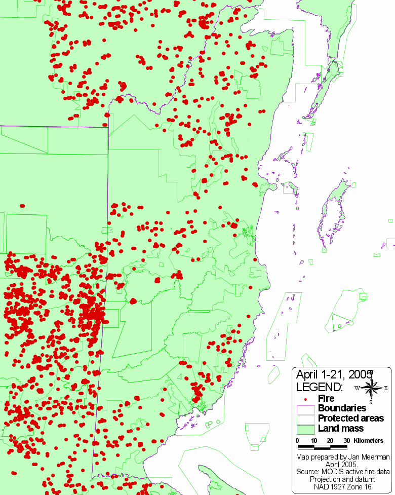
Accumulated fires for April
2005. Notice:
-
Increase of fires in neighboring
Peten (Guatemala) and
-
-
Heavy savanna fires in the coastal
plains.
-
Agricultural fires in the south
of the Columbia River Forest Reserve.
- Agricultural fires (Guatemalan incursions) in
Caracol Archaeological Reserve.
|
|
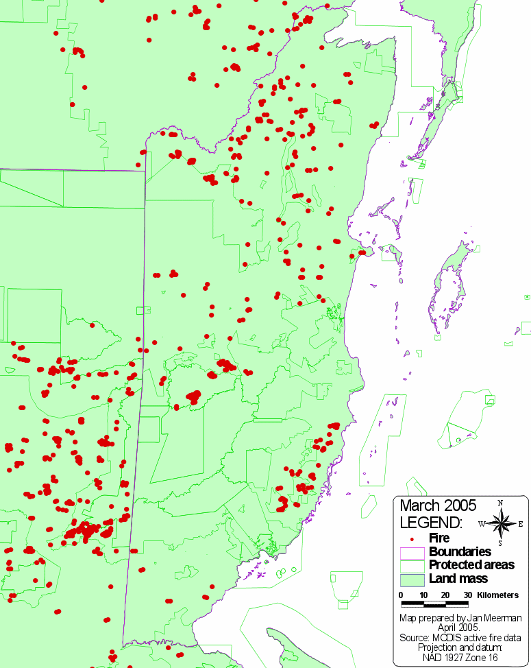
Accumulated fires for
March 2005. Notice:
- Large fires in the Mountain Pine Ridge Forest
Reserve partly resulting from military exercises.
- Fires resulting from vegetation clearing in the
Chalillo dam area.
- Agricultural fires in the south of the Columbia
River Forest Reserve.
|
|

|
Accumulated fires for February
2005. The fire intensity is slowly intensifying.
Particularly there is an increase in savanna fires.
|
|

|
Accumulated fires for January
2005. The dry season is only just starting
and there are relatively few fires still. Yet, in a
"normal "year, it would have been too wet
still to have any fires. |
For images that are updated every few hours, go to this
Colorado State "Real-time
Satellite Rainfall and Fire Products for Central America"
site.
Read more
about fires in Belize's forest ecosystems.
Click
here to view and build customized maps of active
fires in Mesoamerica through SERVIR and MODIS.
Back
to top | Climate
|
Protected areas
| Topography
About
Belize|Administrative|Publications|Species
List|Projects|Links|HOME
|


